Using Unmanned Aircraft in Long Range Applications
Beyond radio line of sight civilian, security and military missions, anywhere in the world.
Swarm technology
Using a formation of intelligent Unmanned Aircraft
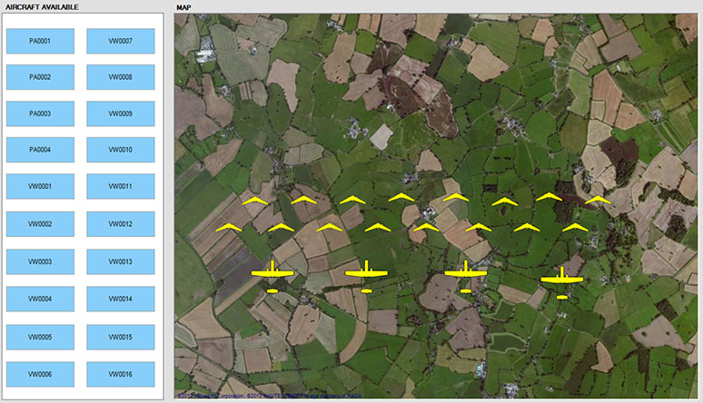
There are many advantages to using a formation of UAVs, rather than a single UAV, to perform a mission.
- Reduced time to complete a mapping mission, since multiple UAVs can fly line abreast to map a much wider swathe, so we get the results sooner.
- Increased probability of completing the mission, since the failure of one UAV in the formation does not stop the mission – we simply experience a graceful degradation in capability, and it will just take a little longer to complete the mission with fewer unmanned aircraft.
- Reduced mission cost, since the mission cost is dominated by the salaries of the three people at the GCS (Pilot–in–Command, Safety Co-Pilot and the Payload Operator). Clearly the staff costs will be spread over the UAVs in the formation, leading to a greatly reduced mission cost and duration.
On-board machine intelligence is essential to detect statistically significant anomalies
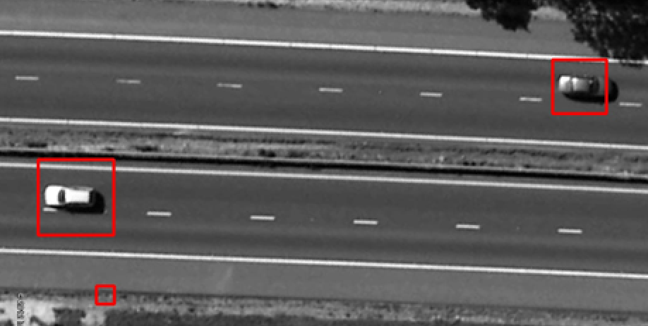
- On board machine intelligence on each UAV reduces the amount of information that needs to be relayed from the UAV to the Ground Control Station, and reduces the number of payload operators needed at the GCS to monitor the detection of statistically significant anomalies (such as people, vehicles and / or weapons)
- Machine intelligence is used on each UAV to interpret video data from visible spectrum machine vision cameras and from thermal imaging cameras in real time
- The hardware and the software for use in machine intelligence applications are both progressing rapidly as a result of the global interest in development driverless vehicles

Rather than have one payload operator per unmanned aircraft in a formation of UAVs, we use machine intelligence to interpret sensor data in real time on each unmanned aircraft to detect statistically significant anomalies, and then only relay information when an anomaly is detected.
Large Scale Mapping
Real time 2D and 3D mapping helps assess critical situations
2Fovi mapping
2D and 3D mapping
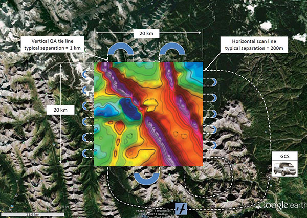
Airborne multi-spectral imaging and geomagnetic survey
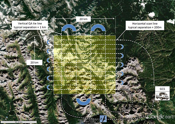
Traditionally, a single manned, or unmanned, aircraft would fly a raster scan to perform a survey, as shown above. The advantage of using a formation of UAVs, rather than a single UAV, to perform a geophysical survey is lower cost because staff salaries are the dominant cost, and the three staff members at the GCS can manage a formation of UAVs from one GCS. Additionally, the survey is also completed more quickly.


Military and security applications
Cargo transportation using the Panchito VTOL capable unmanned aircraft
- Stockpile ammunition, food, water and medical supplies at an unattended location for later use by reconnaissance (recce) troops, leaving no tell-tale footprints, or tyre tracks, to the stockpile. The recce troops can also send back captured documents and weapons using the cargo UAVs
- Transport spares for a broken down vehicle in a location that might be difficult to reach
- Cargo transportation using a formation of VTOL UAVs with automatic cargo detachment capability will allow you to transfer huge cargos quickly, even if bridges are destroyed, roads are impassable and / or the destination is in a difficult location, such as in a jungle, or in a combat zone
Radio relay via satcoms terminal on a high flying InView ESM UAV (seen on the front cover)
- Use a lightweight, inexpensive PMR-446 (“Walkie Talkie”) transceiver on the ground to communicate with a PMR-446 transceiver connected to a satcoms terminal on an InView ESM UAV. The satcoms terminal on the UAV will then connect you to Headquarters, regardless of where you are on Earth
- You can use the 2.4GHz Wireless Local Area Network (WLAN) link between your laptop on the ground and the 2.4 GHz wireless modem on the UAV that is connected to the satcoms terminal to provide you with Internet connectivity, and you do not need to carry a satcoms terminal with you
Use the InView ESM UAV in an Airborne Warning And Control System (AWACS) role
- Use the scanning Solid State RADAR mounted in the nose of the InView ESM UAV to detect low flying aircraft and helicopters, and relay that information to the GCS via the satellite communications link, as the InView UAV circles the area of operations for hours on end
- When the InView ESM UAV is flying below 1,000 feet Above Ground Level, the RADAR on the InView ESM UAV will also detect moving of distant vehicles
- Control a high resolution pan, tilt and zoom video camera on the underside of the InView ESM UAV, and relay the imagery to the GCS via the satellite communications link to provide the staff at the GCS with real time situational awareness of what is going on in the region being patrolled by the UAV
Maritime patrol
- Unmanned aircraft equipped with Synthetic Aperture RADAR (SAR – to detect oil slicks) and an Automatic Identification System (AIS – look at the ships with their AIS turned OFF) can be used in maritime patrol applications to detect illegal activities at sea, including illegal fishing, piracy, or emptying of oil tanks at sea

Anti-poaching
- Use a formation of UAVs, flying in elliptical flight paths, to detect poaching activities in a game reserve
Border patrol
- Use a Follow - the - Leader formation of unmanned aircraft to provide unbroken monitoring of a porous border, using on-board machine intelligence on each UAV to automatically detect people and vehicles
Modular UAV construction allows the unmanned aircraft to be configured to suit any mission
- Ease of transportation of the UAV modules in a van, allowing for assembly at the launch site
- Ease of maintenance of the UAV – just replace a faulty, or damaged, module so the UAV can soon fly again, while the faulty or damaged module can be cost effectively repaired in a local workshop
- Ease of upgrading a module, for example, the autopilot, without incurring a huge expense
- The UAV configuration, for example, the wing span (can be increased to carry extra fuel for long range missions), or the sensor tray, can be changed to suit the mission
Unique capabilities of our Unmanned Aircraft (UAV)
- Local machine intelligence and decision making are present on each UAV
- Each UAV is equipped with an automatic collision detect and avoid system
- Each VTOL capable UAV can operate from a rough grass strip – no runway is needed
- Internet Of Things (IOT) mesh network wireless connectivity between UAVs in a swarm
- Each UAV has a satellite communications link between the UAV and the Ground Control Station


